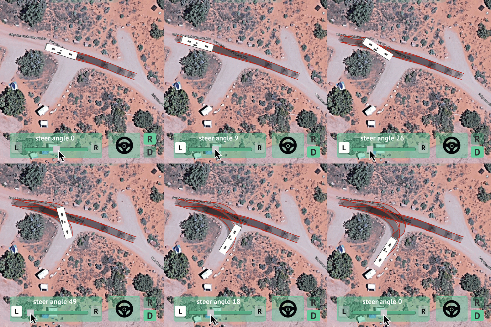
Vehicle Tracking Software
Easily analyze the path of your truck, RV, trailer or other large vehicle and see if it can safely make it into a parking spot, loading area, camp site, or where ever you need to go!
How Does It Work?
Using exact data on your vehicle’s turning radius, wheelbase, dimensions, and more, you can easily see the path your vehicle will take, overlaid on a satellite image of the place you plan to take it.

Input Vehicle Info
Provide your vehicle measurements for an accurate, real world swept path.

Map It
Pull up your destination on satellite mapping imagery.

Track It
Maneuver your vehicle through a turn or into a spot, visualizing it’s swept path.

Why Use Turn Analysis?
Safety
Damage Protection
Confidence
FAQ
What is Swept Path Analysis?
Swept path analysis is a technique, commonly used in engineering and urban planning, to determine the path that a vehicle or other object will take as it moves through a particular area. It is often used to assess whether a vehicle can navigate through a given space without encountering obstacles or causing conflicts. Our software takes into account the dimensions of your vehicle or vehicle combo, its turning radius, and other factors to simulate its movement and identify potential issues such as collisions, tight turns, or insufficient clearance.
How accurate will this be?
Your vehicle will be scaled accurately on the road you place it in the satellite image, to within a few inches of it’s real world scale at that same location. Our software replicates the real world turn characteristics of your vehicle by taking several factors into account in addition to it’s specific dimensions, including number of axles, placement of axles, wheelbase, tire diameter, and hitch location if towing. This results in an accurate representation of the turn your vehicle will make if driven the same way.
How many turns can I perform or analyze using this software?
With an active subscription, you can perform an unlimited amount of turn maneuvers for each vehicle combo in your plan.
